Exploring: Pony Express
Pony Express Trail, Scenic Journey Back Through Time
April 3 1860, the first rider sets forth and the Pony Express begins. Almost 140 years later the Pony Express Trail still provides a fantastic way to see the countryside as these early riders did.
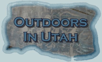
Take some time to explore this area. The Pony Express Trail stretches 133 miles from Fairfield to Ibapah Utah. It winds through different regions of terrain. From the brown colors of the desert to the red and green hues of the more alpine regions, this trail will please the senses. When stopping at the desert stations one can smell t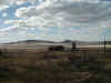 he sage in the air. If you close your eyes and imagine you can almost hear the sound of hoofbeats. The beauty of this region is it's lack of civilization. The land stretches out to the horizon unspoiled by the hand of man.
The
Pony Express was the idea of William H. Russell, backed by his
partners Alexander Majors and William B Waddell. These fellows
built or refurbished stations along a trail stretching
from St. Joseph, MO to Sacramento, CA. Starting with 80 riders,
500 horses, and 150 stations the Pony Express could deliver mail
in 10 days. Riders would cover between 75 to 100 miles per day,
switching horses at the stations along the way. For risking
their lives the riders were paid 100 dollars a month. Most were
very young and thin and wiry in stature.
Beginning out of Fairfield the trail is paved until you cross
Highway 36. Every time I have driven this trail I have fallen
into continuing straight on over 36, this trail leads up into
the Onaqui Mountains. You have to turn left on 36, drive about a
¼ mile and turn right. About a ½ mile in you will come to the
first of the interpretive sites along this trail.
The Pony Express ran until Oct 28 1861, the Trans-Continental
telegraph line was the doom of the Pony Express. One of the
biggest claims to fame of the Pony Express was the delivery of
Lincoln’s inaugural address to California in 7 days and 7
hours.
There are remnants of the stations scattered along the trail and
at the Lookout Pass station there is a pet cemetery. The wife of
the station master could not have children and buried her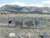 beloved pets in a small cemetery. At the Simpson Springs station
there is the remains of a house built with stone from the first
station house. This house was built by a homesteader named Alvin
Anderson. He constructed it for his wife, but she died in
childbirth before ever living here. The plaques at the stations
provide some history on the area but are repetitive.
beloved pets in a small cemetery. At the Simpson Springs station
there is the remains of a house built with stone from the first
station house. This house was built by a homesteader named Alvin
Anderson. He constructed it for his wife, but she died in
childbirth before ever living here. The plaques at the stations
provide some history on the area but are repetitive.
This trail is fairly popular until the Simpson Springs station,
after this you will not see too many other vehicles. We didn’t
see another car for the last 50 miles of the trail.
At every station was a station master (in charge of all
operations), blacksmith, and spare rider. These stations were
not a very luxurious place to live, although scenic the
amenities were rather squalid. Pony’s were jockeyed between
stations.
 The Pony Express Trail continues all the way into Nevada, be
prepared to spend at least 5 hours or much longer to travel the
entire distance. This trail could be navigated by any type of
vehicle including passenger cars, allow extra time for travel in
any non-four wheel drive autos.
The Pony Express Trail continues all the way into Nevada, be
prepared to spend at least 5 hours or much longer to travel the
entire distance. This trail could be navigated by any type of
vehicle including passenger cars, allow extra time for travel in
any non-four wheel drive autos.
The Camping
There are numerous places to camp along this trail. Simpson
Springs has an organized campground with restrooms and water.
There are numerous other established camping spots on BLM land.
Please only camp in spots where it is evident people have stayed
before. If you camp in the backcountry be sure and take out all
your trash and any you find. This area is popular with the
four-wheeler and motorcycle crowd, be prepared to wake up to the
noise of a two stroke if you camp early on in the trail.
Four Wheeling
This region of Utah is a favorite with the riders of quad’s,
motorcycles, and trucks. The rolling hills are composed of
anything from sand to gravel. Steep hills off the Pony Express
Trail can challenge every type of off road transportation. I
have taken my Tacoma up some of the near vertical hills off this
trail, when you can’t see anything but the hood of your truck
you know it’s steep.
Overall
This is an awesome day trip, but be prepared. The stations the
riders relied on are no longer there. I rolled into Wendover
with a quarter tank, if your truck does not get very good gas
mileage you will want to bring some extra fuel along. Make sure
your vehicle is in good shape, a breakdown could mean walking
for quite a while. This trail is best done one-way, I-80 via
Wendover is the best way back home.
Enjoy your time outdoors in Utah!
Nearby Areas:
Notch Peak
Mineral Mountains
Willow Canyon
Resources
Shopping
Books
| |
Utah
Atlas and Gazetteer
by DeLorme (Editor)
Book Description
Rely on the Utah Atlas & Gazetteer for the utmost in
trip planning and
backcountry access. Contains topographic maps with
unbeatable
detail, plus gazetteer information on great places to go
and things to do.
Scale equals 1:250,000 or 1"=4 miles. Contour
Interval is 300'. Each
page covers 37 miles... Read
more |
Utah's
National Parks: Hiking, Camping, and Vacationing in Utah's Canyon
Country: Zion, Bryce, Capitol Reef, Arches, Canyonlands
Utah
Camping: The Complete Guide to more than 400 Campgrounds (Foghorn
Outdoors)
Camping
Utah (Camping)
Utah
Camping Guide : The essential handbook for ...
Backcountry
Adventures: Utah: The Ultimate Guide to the Utah Backcountry for
Anyone With a Sport Utility Vehicle
Backcountry
Moab - Where The Tours Don't Go
Exploring
Canyonlands and Arches National Parks
Hiking
and Exploring Utah's San Rafael Swell
Utah
Underground: Guide to Real Fun
Travel
Smart: Utah
Hidden
Salt Lake City and Beyond: Including Park City, Deer Valley, Alta
and Snowbird
Get the 2005 Trailer Life Directory for 50% off the cover!
Return
to Exploring Index